Snapshot
The State of Uttarakhand was formed on November 9, 2000 by carving out 13 hilly districts from the state of Uttar Pradesh. Uttranchal, as the new state was called was later renamed as Uttarakhand and became the 27th state of India.
It is strategically located and forms part of the northern boundary of the country, sharing borders with Nepal and Tibet (China); it touches Tibet in the north, Himachal Pradesh in the west and northwest, gangetic plains of Uttar Pradesh in the south and Nepal in the east.
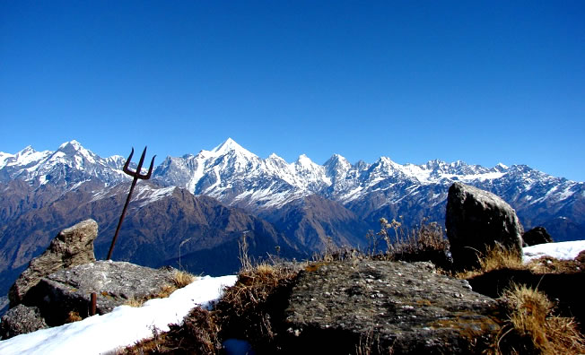
Uttarakhand has diverse geographical features ranging from snow-capped mountain peaks in the north to tropical forests in the south; its climate and vegetation is equally diverse.
It is one of the five states in India to be declared a world heritage biodiversity site by UNESCO.
The state occupies an area of 53,483 sq kms and has a population of 10.1 million based on 2011 census figures.
Its administrative and legislative capital is Dehradun.
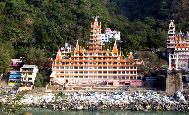
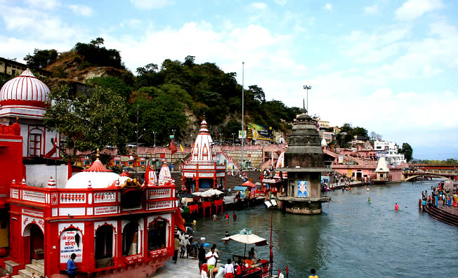
Uttarakhand formerly Uttaranchal, is a state in the northern part of India. It is often referred to as the "Land of the gods" due to the many holy Hindu temples and pilgrimage centers found throughout the state. Known for its natural beauty of the Himalayas, the Bhabhar and the Terai, the state was carved out of the Himalayan and adjoining northwestern districts of Uttar Pradesh on 9 November 2000, becoming the 27th state of the Republic of India. It borders the Tibet Autonomous Region on the north; the Mahakali Zone of the Far-Western Region, Nepal on the east; and the Indian states of Uttar Pradesh to the south and Himachal Pradesh to the northwest. The state is divided into two divisions, Kumaon and Garhwal, with a total of 13 districts. The provisional capital of Uttarakhand is Dehradun, which is also a railhead and the largest city in the region. The high court of the state is in Nainital.
Archaeological evidence support the existence of humans in the region since prehistoric times. Among the first major dynasties of Garhwal and Kumaon were the Kunindas in the 2nd century BCE who practised an early form of Shaivism. Ashokan edicts at Kalsi show the early presence of Buddhism in this region. During the medieval period the region was consolidated under the Kumaon and Garhwal kingdom. By 1803 the region fell to the Gurkha Empire of Nepal and with the conclusion of the Anglo-Nepalese War in 1816 most of modern Uttarakhand was ceded to the British as part of the Treaty of Sugauli. Although the erstwhile hill kingdoms of Garhwal and Kumaon were traditional rivals, the proximity of different neighbouring ethnic groups and the inseparable and complementary nature of their geography, economy, culture, language, and traditions created strong bonds between the two regions which further strengthened during the movement for statehood in the 1990s.
The natives of the state are generally called either Kumaoni or Garhwali depending on their place of origin. According to the 2011 census of India Uttarakhand has a population of 10,116,752, making it the 19th most populous state in India. Garhwali and Kumaoni are the two main regional languages with Hindi being the most widely spoken language.
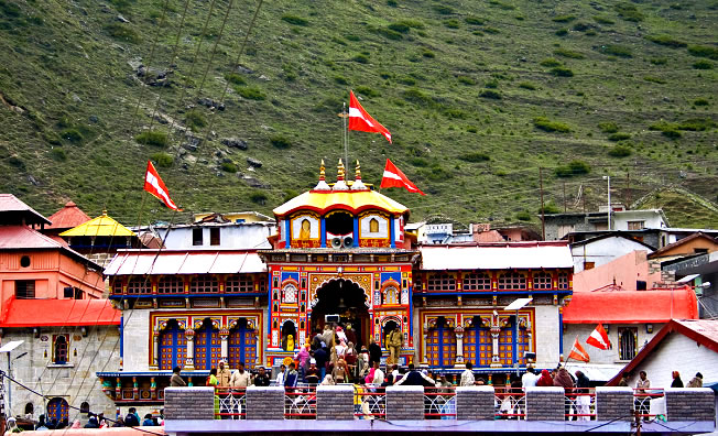
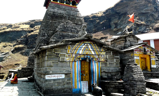
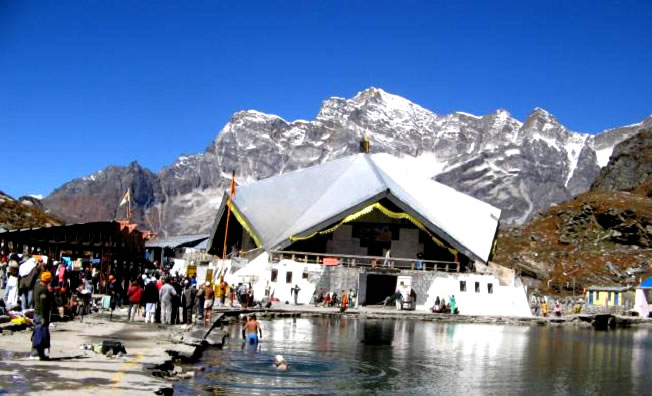
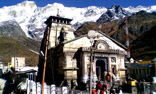
Two of the most important rivers in Hinduism originate in the region, the Ganga at Gangotri and the Yamuna at Yamunotri. These two along with Badrinath and Kedarnath form the Chota Char Dham, a holy pilgrimage for the Hindus. The state also hosts the Bengal tiger in Jim Corbett National Park, the oldest on the Indian subcontinent. There is also the Valley of Flowers, a UNSCO world heritage site known for the variety and rarity of the flowers and plants found there